Monday, March 30, 2009

The Sleeping Princess

Have you seen this video? I think it's pretty cool.


Here are two more:


Sunday, March 29, 2009

Trilobite Hunting

Randy and I finally broke down and went to the U-Dig Trilobite quarry (http://www.u-digfossils.com/) about 50 miles from Delta yesterday. We've talked about going for a few years but just have never gotten around to it. Also, when I found out it cost $28 for two hours of hunting, I wasn't too thrilled. But we went anyway, and we found out Utah residents get a 20-percent discount.

We dilly dallied on the way, stopping at Tommy's Burger in Provo for a hot dog and a chicken sandwich. If you've never been to Tommy's you've never had lunch, and you're actually breaking a Utah Valley ordinance if you drive past Provo without stopping at Tommy's. But go soon--Provo City has been talking about condemning the block and turning it into a parking lot for a new strip mall, because everyone knows nothing adds personality and defines a city like a strip mall. We need to get rid of all the quirky old mom-and-pop shops, anyway.

Guess I digressed. But Kevin and I ate lunch at Tommy's almost every single day one year when we worked at Novell. It's like home.

Anyway, when Randy and I realized we still had 20 miles of dirt road to go before the quarry and it was about 3:30 p.m., and we remembered the website had said the trilobite farm would shut down at 4 p.m. if no one was there, we decided to hurry.

We got there in time, gave Gene our $23.30, and he gave us each a five-gallon bucket and Randy a rock hammer (I already had one, and a pry bar). By the way, the road was graded and well graveled and easily traversed by any car until about the last 200 yards, when it dips down a steep, bumpy hill, passes two porta-potties, and climbs back up a steep hill.

We walked down to the side of the excavated hill (for part of your hunting fee, they dig out the rock with a big back hoe), where another couple was whacking at rocks. And we started whacking at rocks. The rocks are limestone shale, so they split apart pretty easily, and they're reasonably easy to pull out of the mountain or the ground. A lot of loose rocks are also lying around to whack on.


This is what an old miner looks like hunting trilobites.


This is what a real pro looks like. (This isn't a pro, but this is what one would look like.)


This is what a little trilobite looks like in its shale bed.


Some are buried in the rock, and they won't come out in one piece.


Some will come out of the rock more or less intact (this one seems to be less; I think this thorax is missing its cranidium and pygidium, like I know what those are).


These trilobites are said to be about 550 million years old (think of it this way: if we paid $20,000 a year on our national debt it would be paid off in 550 million years).


Trilobites were the first invertebrates on the earth--they have an exoskeleton like a crab. Also like crabs, they crawled around and got their food on the bottom of oceans.


The largest trilobites in this quarry are about two inches. We found several large ones, but I didn't find any big ones that were in one piece, although Gene, the guy running the place dug out three or four while we were there.


I also found these fossils but don't know what they are. They look like worms or plants. Gene didn't know what they were, either, and said to ask a paleontologist. They seem to be in pairs and maybe in a V shape (thus a plant?). If you know what these are, please clue me in. On the right are the objects, and on the left are their impressions on the opposing slab of shale.


This adventure was well worth $23.30. Kids six and under are free, and youth seven to 16 are about $13, if you're a Utah resident.


If you're near Delta in the early spring, you can also watch the ranchers burn the weeds along their fence lines.


And if you're in Elberta anytime, you can see the house we built for a family when I worked for Utah County almost 30 years ago. If you look closely, I think there's a ghost in the window on the right (click on the picture to enlarge it).

Moab 1/2 Canyonlands, Big B-Day, and Arches

Ditto what Jamie and Sara posted on Moab and their run. They both did great.

Mialisa and John sent Chieko these beautiful flowers for her birthday.

Sunday, March 15, 2009

Wendover to Oasis

Click on any picture to enlarge it.


I bet you thought people went to Wendover just to worship in the Peppermill, Red Garter, and Nugget.


Or get entangled in one of the other casinos in this oasis in the desert.


You might be surprised to find active churches in the shadow of the bright lights of the casinos.


And an LDS church that's much bigger than the building we meet in.


You might also be surprised to find out Wendover played an important role in World War II.


More than 1,000 flight crews trained here for bombing missions over Germany.


But more famously, this is where the designs for the atomic bombs dropped on Japan were tested and the flight crews for the Enola Gay, which dropped the bomb on Hiroshima, and the other atomic bomber planes trained.


After the "Little Boy" was dropped on Hiroshima and "Fat Man" on Nagasaki, Japan didn't surrender immediately and a third Fat Man left in a plane from Wendover. The Japanese finally surrendered and the plane was sent back to Wendover from just beyond California.


The buildings are in pretty sorry shape today, but the tower still stands, one building was just remodeled as the Wendover terminal, and a couple other buildings are undergoing slow renovation. One restoration that's close to complete is the officers' hall, which will once again host dances and other events.


About 30 miles past Wendover is another little town that hasn't fared so well. Oasis is for lease if you're looking for a business that's too close to Wendover in one direction and Wells and Elko in the other to be much needed as an oasis on I-80.


I don't know when the place closed shop, but this truck looks like it's been waiting a long time for the service station to open.


An ice cream might sound good if you're passing through here in the middle of summer.


It looks like the owners left in a hurry--cups still fill the Pepsi dispenser.


You can almost see someone enjoying a chicken fried steak with an ice cold soda.


Then again, the desert is harsh. Even those that are well suited for this environment don't last long.


Sunday, March 8, 2009

Nine Mile Canyon Petroglyphs and Other History

Click on a picture to enlarge it.


First of all, don't come on this road thinking it's only nine miles long. I drove about 85 miles from Wellington (just outside Price) to Myton (just outside Duchesne), of which about 20 miles were paved. The rest is well maintained gravel and dirt, but it can be a bit rough and slippery in spots. I brought home a ton of mud caked to my Tahoe from top to bottom. A car should have no trouble in the summer (I passed a Honda Element), but you might need new shocks when you're done.


The road was originally built to send supplies from the train stop in Price to soldiers at Fort Duchesne in the 1880s, and it became the most heavily traveled road in Eastern Utah during the late 1800s. There's even a story that the Wild Bunch planned to rob the soldiers' pay wagon and kill all 20 guards. Someone, possibly Butch Cassidy, tipped off the Army because, though he wasn't involved, he figured he'd be blamed and the Army would be relentless in its search of the murderers. So the Army doubled its guard, and the gang chickened out.


The main attraction along this road, which some call the "world's longest art gallery," is more than 1,000 rock art (petroglyph) sites with more than 10,000 individual drawings, a larger concentration than anywhere else in the world, according to Wikipedia.


Besides the Fremont Indians (and maybe others, including Utes), ranches, farms, and a town with post office, hotel for wagon travelers (it took six days to get from Price to Fort Duchesne), and store have occupied the land along this road.


Today these homes may not offer much protection, but the cows still think they're cool.


A few small ranches, cattle herds, and homesteads still dot the landscape.


This herd had 36 deer in it. I found that if I parked behind an old cow shed and crept very, very slowly, the deer would watch me but wouldn't run. I walked mostly in the shadow of the shed, then did a crouching walk up to and behind a wooden fence until I was pretty close.


Squatting on the balls of my feet, I lost my balance for a split second and swung my arm back to rebalance. That's all the deer needed as their signal to flee.


I'm guessing there were plenty of deer (or elk or big-horn sheep or pronghorns) during the Fremont Indians' stay here 800 and more years ago.


Guess what they call this rock. That's right, croquet ball. Just kidding. Did you say balanced rock? Ha ha. That's wrong. It's called Pig Head Rock.


I get the man leading the horse with a rider, but I'm not sure what the roundish thing is. A ball of fire, the moon, the sun?


What kind of animal is this? I think it's either a baby elephant or a dog that just ate a snake.


Probably not a problem this time of year, but there are snakes in this canyon, and apparently the Fremonts noticed them, too.


These indentations in the rock (if they look like bubbles to you, poke yourself in the eye, or try clicking on the picture to enlarge it) are in an alcove and are believed to be where corn was ground.


This is a grainery high on the side of a cliff in another alcove.


This icy pool had a strong sulphur odor, which makes me think there's a hot spring worth finding somewhere way upstream.


I wondered if these petroglyphs went right up to where the next layer of rock jutted out. If so, we can see how much rock has sloughed off in the past 800 or 900 years.


I wonder what these dot and line patterns are, fields of corn and other produce maybe? With deer walking around them.


Nine Mile Canyon is pretty active, with natural gas being pumped and quite a few heavy trucks traveling up and down the road, which is good in that the road has to be kept passable throughout the year. Just past a big natural gas compression plant are the remains of a Fremont Indian village and something called "The Big Buffalo." I hiked way up the side of the mountain and never found the village--I think it was covered in snow--or the buffalo, but I found this cool rock formation.


What do you suppose they call this rock? Did you say "Mummy Rock"? Pat yourself on the back and do the King Tut dance.


I still had several stops on my map when I suddenly realized the day was almost over.


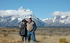
This part of the country is at its most beautiful in the early morning and in the evening.


You can't argue with that, huh.


Quite a few oil or natural gas dereks dot the hills as the road gets closer to Highway 40 and Myton.