I like to go into the west desert in the winter, because the east mountains aren't as accessible, except for skiing and snow shoeing. Here are some pictures from the past few winter weekends in western and southern Utah.
 If you saw the eagle perched on a utility pole on my Facebook page, you're probably wondering if this is the same eagle and why the sky is white. It's the same eagle, and the sky in the other picture is blue because of PhotoShop. Now look closely at this and tell me whether that's a mouse in the eagle's clutches.
  I love how the utility poles, fence and train tracks all follow the same line. I guess that's expected, but it looks cool.
  This is Magnesium Corporation of America, MagCorp, which is in the news frequently for polluting. A titanium plant is next to MagCorp.
  I drove out to the Great Salt Lake shore on February 5. I got off I-80 at the Lakepoint exit (Tooele exit), and as I exited I saw a guy parked on the eastbound side of the freeway and walking across the 75-mph lanes. "Natural selection," I thought. As my exit ramped met the ramp that enters I-80 westbound, I noticed a couple other cars parked and people walking toward this collection pond. This is right where the westbound on-ramp transitions from a 55-mph straight ramp to a sharp right-hand 20-mph loop. It took me a second to figure out that a vehicle had gone into the pond, and by then I was past the point of being able to stop safely, although I considered going back. But because a few other drivers had stopped, I decided to continue on to Subway. Plus, a Highway Patrol car arrived just as I was leaving the off-ramp. While waiting in line for a sandwich, I saw a couple of fire trucks and an ambulance go by. With my sandwich on the passenger seat, I tried to get back onto I-80 westbound, but the ramp was blocked by emergency equipment. So I U-turned and got on the freeway eastbound, made a U-turn at Highway 201, and headed west again on I-80. As I passed the accident I snapped this picture. On the way home later in the evening I heard on the news that the Utah Highway Patrolman who had arrived was Travis Williams, whom I had taught when he was in my 13-year-olds' Sunday School class. He's Sara's age. Apparently two women had gotten out of the van, but one was unable to get out of her seat and was screaming, so Travis went into the ice-covered water and freed her. I still wonder if I should have, could have stopped and helped. Apparently the other drivers didn't go in to get the lady out, and she ended up in the water for 20 minutes. I think or hope I would have gone right in to help if I had stopped. The lady had hypothermia, but was okay. The driver said she'd been cut off by another car, but that is hardly possible, since there's only one on-ramp lane and had been for 1/4 mile. She just wasn't paying attention to the sudden curve, I'm sure.
  This train is crossing the road that goes to MagCorp.
  I travelled on I-80 past Delle and got off at the Lakeshore exit. About 20 miles north of I-80 is this rock and a small gravel pit that is a great place for target shooting. Just past here, the road makes a left turn onto "No Tresspassing" U.S. Air Force property. A dirt road continues north to the shore of the Great Salt Lake. It goes through a fenced-off munitions disposal area that is posted with signs that tell drivers to stay on the roadway. A gate at one point has a sign that says something like, "Closed for bomb disposal." The gate is usually open.
  At the lake's shore is a strip mine. I think this is just a rock mine for roadbeds and such. It doesn't look like there are any valuable minerals, but I don't know for sure. I came out here about 10 years ago and found several white camouflage military tanks lined along the shore. Unfortunately, I've found no trace of them since.
  This tire must be difficult to repair.
  Trains run through the mine property.
  Above the mine is a hill with a radio tower, a great place to view the lake. This causeway is the Lucin Cutoff, which takes the railroad tracks across the lake rather than around to the north, along the route the original Transcontinental Railroad took.
  This is a view of the Lucin Cutoff form another hilltop to the east of the mine.
  This area has bizarre rock formations. I think this is the skeleton of the famous Great Salt Lake Monster. See his eyes and nose?
  This looks to me like a moonscape, but I know I'm not on the moon, because I can see it rising in the east.
  Along the south side of this hill is a fenced area, part of the bombing range or munitions disposal area. This tank is in a little wash that also has a couple of burned-out cars, a tipped-over pickup truck, another tank, a missile on a stand, and a couple of black buildings. I assume these are all targets, or very unfortunate Weekend Warriors.
  This lava rock is full of cracks that have been filled with a carmel-colored mineral.
  I can usually depend on seeing antelope whenever I come into the west desert.
  This is an island in the Great Salt Lake north of the mine at Lakeshore.
  To the right in this picture is a the Lucin Cutoff causeway with a train heading east. From the radio tower I could see the lights from trains while they were still in Nevada. The sectioned areas in what I think is Clyman Bay are evaporation ponds. The water collects in these ponds and evaporates. Then workers collect the leftover salt, minerals, and precious metals that had been suspended in the dense water.
  Sunset over Clyman Bay.
  On Monday, February 7, we went to the Weavers' for Superman Tanner's birthday.
  He wanted and got an Easy Bake Oven. Tanner is quite the food connoisseur--he has always loved shrimp and other expensive foods. So I wasn't surprised to hear he wanted an Easy Bake Oven. Then I wondered why it's always been marketed to little girls--it has pictures of little girls on the box--especially considering that the majority of famous chefs are men.
  On Saturday, February 12, I drove out to Antelope Island. This is a state park and costs $9 per car to enter. It's a great place, especially this time of year. The island is accessible by this causeway (Antelope Drive exit from I-15).
  A thin layer of fresh water on top of the heavy salt water of the Great Salt Lake freezes. The wind and water then push the ice into these piles.
  This is my Sequoia crossing the causeway.
  The visitor center is worth a stop, and it's home to this fiberglass bison that has forward-pointing horns. I don't know what is normal for a bison, but the live ones I saw on the island had upward-pointing horns.
  This is looking south from Buffalo Point. They're too small to see in this picture, but seven bison bulls are down in the valley on the left side of this picture. While I was cooking and eating my freeze-dried beef stroganoff, the bison wandered up to the road just below the Buffalo Point picnic area.
  After a short staredown with the car, this bull did a little jump to his right and walked off.
  The bulls were meandering around eating the winter grass.
  Here's a herd of bison on the way to the south part of the island. I'm on my way to the Garr Ranch.
  The ranch looks like a pretty fun place for kids and families.
  Inside a workroom on the ranch.
  A housing room on the ranch.
  This is a stroller from some bygone time.
  A few old tractors line a fence behind the ranch buildings.
  These tractors are really old, but they look like they still run. There used to be a Massey Ferguson sales lot on State Street and about 5800 South, where there is now a gas station. We walked past the lot every day on the way to and from junior high school.
  This is Salt Lake City as seen from the Garr Ranch at the south end of the paved road on Antelope Island. The island continues farther south, but the dirt road from here is closed to the public.
  This is looking toward Kaysville and the Weavers' house from just north of the Garr Ranch. I'm pretty sure the white structure is the concrete silo next to I-15 at the 200 North Kaysville exit.
  Antelope Island does have native antelope. The bison are not native. Twelve bison were brought here in the early 1900s from a ranch in Tooele County, which got them from Texas, when bison nearly disappeared from the United States. By disappeared, I mean killed by hunters, who slaughtered them by the millions for sport and to drive the Indians, who depended on the bison, off the plains. About 750 bison from the original 12 now inhabit Antelope Island. They are rounded up yearly, checked for health problems, and vaccinated against diseases such as brucellosis.
  Traveling back across the causeway I saw what looked like a stream within the lake. It broke up the ice on the south side of the causeway.
  On Presidents' Day weekend (Sunday evening) I decided to drive down Highway 89, since I hadn't been on that road for several years. The town in the distance is Aurora, where my dad spent his childhood.
  Dad learned to swim in a canal in Aurora. This is a major canal that runs right through the middle of the town, so I assume it's the one he swam in.
  This is some business now, but it looks like it used to be a school. I'm guessing it's the elementary school my dad attended, but I need to ask him. Maybe it's never been a school, and maybe it was built after he lived there.
  In Panguitch, I stayed in the Color Country Inn, one of only three or so motels that were open. The several other motels had a foot or two of unplowed snow in their parking lots. By the time I went to bed, I was the only guest, but I did see another car when I left about 5:30 in the morning. Once I got here, I decided the only interesting thing to do was to go to Bryce Canyon, and I figured I may as well go see the sun rise.
  Bryce Canyon is a year-round national park, but almost all tourist places around Bryce Canyon are closed for the season.
  I stopped at Inspiration Point just inside the park entrance, partly because I was afraid I would miss the sunrise if I took the time to go farther and partly because the road is closed beyond here. The moon was getting ready to set as I arrived at the Inspiration Point lookout.
  A young guy from Germany was also here. He said he comes to the U.S. Southwest about twice a year and spends four weeks each time. He said people in Europe get more vacation time than people in the United States. He works for a carpet manufacturer in Dusseldorf, which sounds like a very flat, densely populated industrial area. He said it was -2 degrees F in Bryce Canyon when we were there, which didn't take into account the windchill. I'm guessing that was -10 or -15.
  Looking south from Inspiration Point.
  Snow-capped spires.
  I think this is the choir.
  Bryce Canyon bowl from Inspiration Point.
 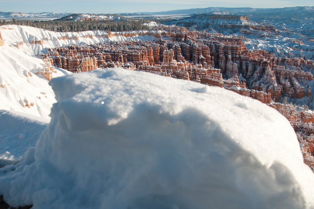 The snow was quite deep. Luckily a lot of people had tramped up to the lookout since the new snow on Friday and Saturday, so the trail wasn't too difficult to negotiate.
  Another view of the snow.
 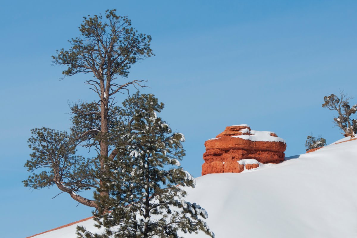 This is going down the canyon from Bryce Canyon National Park. This whole area has rich orange rock.
  A cliff on the drive down.
  I think this is the Sevier River. Those are clumps of ice floating down the river.
  A chilly marriage.
  Don't plan a motorcycle trip for winter in southern Utah.
  This homesteader finally gave up the ghost.
  I think this guy helped build the original Highway 89.
  This is beachfront summer rental property for some lucky family.
  A lot of abandoned homes are scattered throughout this part of the state.
  These are two of 18 12-foot crosses erected to honor Utah Highway Patrol officers who died on the job. The Texas-based American Atheists, Inc., sued the Utah Highway Patrol and a private group that paid for the crosses claiming these are unconstitutional, because crosses are religious. Three stupid judges on the 10th Circuit Court of Appeals found in favor of the atheist group, reversing a lower court ruling. I'm not sure where this case is in appeals, but for now these two crosses are still here.
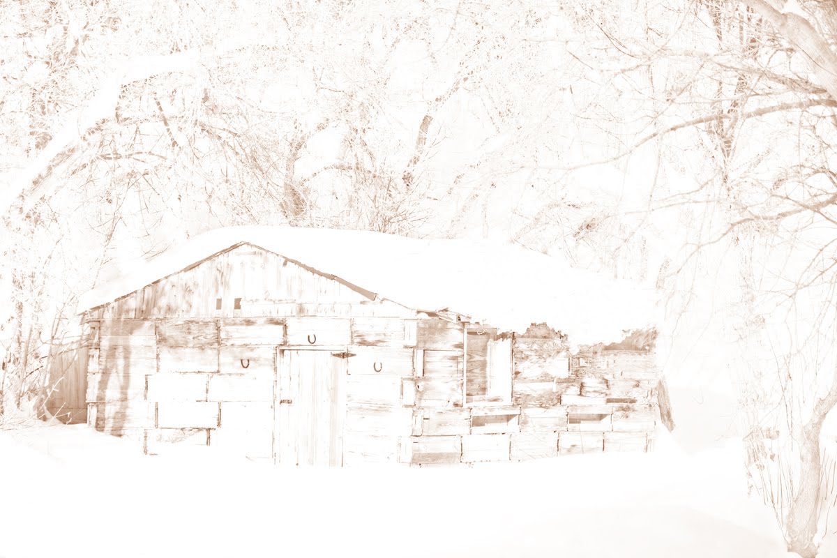
  I've been playing around photographing falling-down buildings in light brown tones.
  I forgot where this cemetery is for sure. It's on top of a hill outside Circleville or one of those towns on Highway 89.
  These petroglyphs (chiseled into the rock) are called Newspaper Rock in Fremont State Park outside Richfield on I-70. There are also pictographs (painted on the rock) in this park.
  The petroglyph that looks like a train is a train. It was carved by Paiute elder Hunkup in the late 1800s after he rode a train to Chicago and back. This is among several pictures that are hundreds of years old, and also some very recent additions. I'm not sure which is vandalism, but anything since 1900 seems like it fits that category.
  This caboose is at the end of a bike trail that was laid on an old railway bed up a canyon. It looks like someone is building a train park. Update (April 2011): I just learned that someone is turning this place into a resort of sorts (maybe the Big Rock Candy Mountain people across the highway), and this and other cabooses will be motel rooms.