After I attended Henry Schein's two-day Dental Service Organization (DSO) Education Forum in Las Vegas, Randy and I took a couple days to goof off. We had no plans, but we did have a couple of ideas. On the first day, we drove out to Little Finland, a county park in the Gold Butte National Monument. The turnoff from I-15 is nine miles south of Mesquite. From there, the road goes past the Bundy Ranch, which I assume is the same Cliven Bundy that had the armed standoff with the BLM a few years ago. The road goes from paved to semipaved to dirt to pretty hairy in places. It runs in and across numerous washes that would make this a dangerous route with any rain.

This is where the road turns to serious 4x4. We did meet a couple guys from San Diego in a Subaru at the end of the trail. Kudos to Subaru.

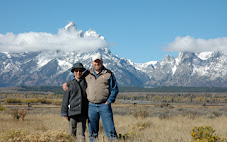
Once you've seen part of Nevada, you've seen all of Nevada. In fact, I think we passed places where we could actually see all of Nevada. You can't quite see it in this picture, but at the horizon behind the Sequoia is Lake Meed.

One of the washes the road follows.

Why you need a 4x4.

Looking out the driver's window.
Here we're going down a narrow piece of road into a wash.

We made the mistake of following Google Maps on my iPhone. We didn't have a printed map or any of the directions that you can find on the Internet. This was poor planning and a bit of a problem, because there's no cell phone signal out here, and we lost our network connection. Somehow, though, it worked well enough for us to find this place.

This is what the side of my Sequoia looks like. I hope these scratches come out in the car wash.

This is called Little Finland because of the fins in the rock formations. It's also called Hobgoblin's Playland and Devil's Fire.

This rock is Aztec sandstone.

There's quite a bit of sand close around Little Finland. If I were to camp, I'd camp here rather than anywhere else on the paths coming here, because everywhere but here is seriously rocky.

The following are photos of the rock formations.


Looking out after you've been swallowed by a whale.

I like how these rocks are hanging precariously.


There is some greenery and a little water that may be slow runoff from rainstorms.


This seam fascinated me. The striations of the rock on one side of the seam don't match the striations on the other side of the seam. How was this formed? If you click the picture and look further on, you can see two parallel seams. It looks like two petrified sand dunes were sliced and a section of sandstone was inserted between them. I guess this really was formed by aliens with heavy equipment.


Sea horse.

This looks like Moqui marbles that were sealed against the sandstone under a thin layer of sandstone.


That's it for Little Finland.

The next day we drove back toward Las Vegas and took Highway 93 north to Alamo, which intersects with Highway 365, also called the Extraterrestrial Highway. Alamo is a "museum and gift shop," by which they mean just a souvenir shop, where it seemed that everything was either $5.99 (ID cards, refrigerator magnets and bottle openers) or $17.99 (T-shirts, hats, posters).

I suppose this is called the Extraterrestrial Highway, because it's the access road to Area 51.

This is Rachel (a town, by which I mean a souvenir shop and cafe).

We took one of the two roads I am aware of that go into Area 51. When we got within a couple miles, we passed this sign, which says drones are prohibited beyond this point. (The elastic bandage on my leg is because I had knee surgery last week.)

Area 51 is a classified military site that his highly guarded. This is supposed to be the place where the military brought the aliens that crashed near Roswell, New Mexico, in 1947. This is the only picture I took, because one of the signs by the entrance here says "Photography of this area is prohibited." A chase truck sat on a hill to the right and some kind of big sensors are placed every few feet along the perimeter (you can see one just left of the center of the picture). There's also razor wire around the perimeter. The lady at the souvenir shop said a guy from New York drove through the open gate one time. He got about 50 feet when two trucks stopped him. The military guys turned him over to the local sheriff, and he was fined $600.

Moving on, this is Goldfield.

This town is quickly transforming into ghost town status. Maybe it's already there. About five gas stations, a large old brick hotel, and several other large brick buildings are all boarded up. Not a single gas station is functioning here. The city is trying to turn itself into a museum.

This is some kind of mining equipment.

A truck pulling a trailer.

Mining equipment.

One of the buildings being restored.

A derelict fire truck.

Another fire truck in front of the fire station.

Here's another Goldfield claim to fame. I guess. I don't know what to call it. This place has six or eight custom vehicles. They used to be in a car lot as you leave town to the north. Today, they're squeezed onto a small lot in the middle of town.

The side of a travel trailer among the custom car collection.

And on the south side of town is the Car Farm. Instructions for finding this (it's not readily visible from the highway) are on a whiteboard at the custom car collection place.

The end.
PS

On the way home we stayed overnight in Ely. Then we visited the Northern Nevada Railway Museum in East Ely. Until Memorial Day, the museum is closed during the week, but the museum director, Sean Pitts, happened to be in the parking lot when we arrived. He said, "We're closed, but I have a key." He then gave us and a retired English teacher from Prescott, Arizona, a really interesting 90-minute tour of the railway offices, replete with a history of the railroad and mining industries in Ely. His story included telling us how the sandstone of the building was wearing out, so he hired two stone masons, one from England and one from Greece. They found the original quarry in Currie, Nevada, contacted the current owner (the guy actually bought the whole town of Currie a few years ago), informed him that he had a quarry on his property, and convinced him to let them quarry some stone. He told how the man from England set 16 wedges in a seam in the rock and then tapped them until the rock split. They then cut it up into blocks and used those to replace worn ones in the building. If you ever get a chance to chat with Mr. Pitts, you should.

This is the rail yard. Unfortunately, the steam engines won't be running during the week until Memorial Day. I plan to come back for the 90-minute train ride the museum offers ($31).

This is a view into the shop.

In the administration building, this is the clerk's office. Notice the telegraph on the right desk. It was used until radio was available in the late 1940s. This furniture was all placed here in 1906.

This is just outside Wendover. I include it to show that there is beauty in the desert.