Friday, October 25, 2019

Spiral Jetty

Another beautiful day. So Chieko and I headed to Spiral Jetty, which is about 16 miles of dirt road from the Golden Spike National Historic Site, or about 120 miles from home.

Spiral Jetty is the work of artist Robert Smithson, who built it in 1970. I've only been there one other time, when the jetty was under water and difficult to see. But we've had several years of drought, and the Great Salt Lake level is way down now. The concept, shape, and location of the jetty all have meaning, but you'll have to look them up on Wikipedia or somewhere.

The following are different views of the jetty in video and photos. Except the ones that aren't.


That's Chieko waving. 

That's also Chieko walking back to the car. 


This plane took off from a beach nearby, circled the jetty, and landed back on the beach. 

Me on the jetty. Yes, I walked the whole spiral to the center of the jetty. 

Several farms around Corinne had corn stalks still standing. We debated whether they were sweet corn that had already been harvested or cattle feed waiting to be harvested. I win. 

Cars driving home on I-15 near Bountiful. 


Iosepa and Surroundings

I just got a new roof on my Z3 convertible and haven't driven it yet, plus I had the afternoon free, and the weather was beautiful. So I decided it was a good day to take a last ride before I put the car away for the winter. 

First, I had to take a picture of the Jensen's beautiful tree. 

This is the road through Skull Valley to Dugway (except I took this picture facing north). This is my kind of road. Long and lonely. 

I didn't realize the Lincoln Highway came down this road. I had thought it pretty much followed today's I-80 west. It actually came this way to Dugway, followed the Pony Express Trail to Nevada, turned left at today's Highway 93 to Ely, turned right at Highway 50 (The Loneliest Road in America) to Sacramento, and on to San Francisco. Someday Randy and I will need to drive the Lincoln Highway from New York to San Francisco. 

Iosepa, which means Joseph for Jospeh F. Smith in Hawaiian, was settle in the late 1800s by Hawaiians and other Polynesian who joined the Church of Jesus Christ of Latter Day Saints and immigrated to Utah to be close to the temple. They originally settle in Salt Lake City, but they were discriminated against by the "white saints." The church tried to find other locations, but they ended up in this desolate spot. They did their best to irrigate and farm, but the town never prospered. When Joseph F. Smith announced a temple in Laie, Hawaii, in 1917, most of the people moved back to Hawaii and Iosepa became a ghost town. Today there's only a cemetery, where people gather each Memorial Day to commemorate the early settlers. 

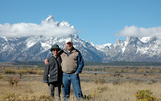
What can I say? This was at a farm house just east of Dugway, which is an army base that no one can enter without military credentials. 

Looking down the canyon toward the south end of the Tooele Army Depot.

A view of Mt. Timpanogos from the highway between Vernon and Eureka. 


Eureka!

This is the Bullion Beck & Champion Mining Company headframe on the south end of Eureka.  


Thursday, October 17, 2019

66 Miles on Route 66 at 66 Years Old


I got the idea from a post on a Facebook page to ride my bike 66 miles on Route 66 while I'm 66 years old. Randy was also planning to go, but he crashed into a heavy black aluminum pole on the Mountain View Corridor trail when he was training for this ride at night about a month ago. He broke his clavicle and three ribs and injured his spleen. But he wanted to go anyway, so he became my support for this ride.

The pipe Randy hit at about 30 mph when he was training for our 66 on 66 at 66 ride. This is a heavy 4-foot-high, 5" aluminum pipe that wasn't broken before he hit it. 

 I rode west from Seligman to Anatares. The wind usually blows west to east, so for that this wasn't the best direction, but it was overall downhill. 

This is across the street from Delgadillo's Snow Cap, where I started. 


I climbed about 1,118 feet and descended 2,673. I averaged 18 miles per hour for the first 55 miles. Then I hit a headwind (probably 10-15 mph), a mild ascent, and tired legs that dropped my overall average speed to 17.1 mph. The road had a wide shoulder for most of the way, but there were about 5 to 10 miles with no shoulder. Overall, the road surface was pretty rough. I'm not sure if it was chip seal or just a worn-out road, with one section of smooth pavement. Oftentimes, the cracked shoulder with grass growing through was smoother than the roadway. The painted white stripe was the smoothest, except when it had a crack down the middle. I don't usually ride on highways with cars, because I'm not a fan of being run over, so I bought a Garmin Varia that uses radar to notify me when a vehicle approaches from the rear. That was very helpful. When a car was approaching, I moved well onto the shoulder. The speed limit on this section of Route 66 was 65 mph. A few cars were easily doing 80 mph or higher. The traffic was light. There were very few semis (long-haul truckers take I-40). Most drivers moved completely into the oncoming lane when they passed, but a few did not. At one point, a car, motorhome, and car passed me. The two cars moved over, but the motorhome didn't move over at all. 
  • I did the 66 miles in 3:51:47. I was really happy to have finished in under 4 hours. 
  • Average speed: 17.1 mph.
  • Maximum speed: 36.42 mph.
  • Average cadence: 85 (exactly my target; yay).
  • Average heart rate: 122 bpm (I'm on a beta blocker that keeps it slow; before the heart attack in July, my average would have been more like 140-145 bpm on this ride).