I taped a 4th Generation iPod Nano with a built-in camera to the bottom of the Flame Wheel. The interference from the motors caused the picture to go wavy, and the duct tape didn't hold up to the vibrations of the drone, dropping the iPod into some sage brush in the West Desert.
This is the same setup: DJI Flame Wheel with 4th Generation iPod Nano. Same West Desert.
Finally, a drone that's easy to fly and has a decent built-in camera.


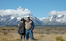
Jamies' neighborhood.
Cross-Country skiing in the Uintas.
Snowshoeing at North Fork.
Target shooting on road to Dugway.
This tracking feature is really cool.
I tried to get close to this eagle in the tree. That he flew off didn't surprise me, but I do need to work on smoothing out my control of the controls.
Our neighborhood from about 50 or 60 feet.

I have a lot of pictures of the front of our house but this is the first from this level.

Looking to the west from about 150 feet high. I can see my dad's house.

Looking south from about 100 feet high.

Chieko often wants me to take a picture of the mountains east of us, but I've never been able to get a photo without trees and utility poles in the way. This isn't a great photo, but now I know I can get those pictures when Chieko wants them.

Now I'm posting stuff from a different day. This is the day after a major snow storm. The camera is looking east at about 50 feet. I stitched four pictures together for this panorama.
Flying up the street.
Snow flurries in the mountains.
The trail to Donut Falls.
Flying over Wheeler Farm.
Flying over me at Wheeler Farm.
Fly over me again at Wheeler Farm.
360-degree view over Wheeler Farm.
Fly over Wheeler Farm looking west to east to south taken at about 300 feet. I think the bobble in the middle is wind.

Sara's house.