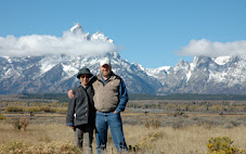
Here are the pictures.

This is a bridge along the Jordan River Parkway. Our Thanksgiving ride from Weavers to Astles was 35.08 miles.

Riding across the bridge.

After-dinner basketball. There is no mercy between father and son.

Sierra shoots as Marcus tries to block.

There is also no mercy between brothers.

But there is compassion from Tanner toward the youngest guy.

Chieko took three shots. An air ball, a close call and a basket. I didn't know. I will remember not to challenge her to ping pong or basketball.

Annie and Owen.

Kali playing the piano in the Relief Society room.
That's a wrap for Thanksgiving.

My first stop Friday afternoon was the dinosaur tracks. I know this road, because I've been on it before, but I forgot there's a wash that's often full of sand. This 4WD truck got stuck and had to unload its ATVs before it could get out.

I decided my only way through would be with speed (or a kind passerby with a tow rope). I chose speed, but I applied it a bit too much, and the bumper took the hit. Luckily I threw in a roll of duct tape just before leaving home, or I'd be dragging plastic parts (the wind guard under the car was also kind of a mess) all over Moab and on the way home. Always carry duct tape. Add a some baling wire and you could open a repair shop.

This is the parking log to the dinosaur tracks.

The Forest Service, or whoever is in charge of this place, has done a nice job building trails, a board walk to keep people off the tracks, and a fence to keep ATVs out. It looks like it's ready for general public viewing, but directions to this place are still available only by word of mouth. Maybe that's the plan to help preserve it long term.

Notice the set of three-toed tracks across the upper right corner of the photo. I assume these are from an allosaurus-like creature. The prints are probably a foot long, and the steps are about three to four feet apart.

This is looking west across a major part of the area. It looks like swampy spot. It's still green (probably copper) and looks muddy, although it is rock.

This area has the thickest collection of prints. It looks to me like there are carnivore prints (three toes) and herbivore prints, like a sauropod, like there were a lot of these guys tromping around here.

In the lower left of the center of this photo is a slash in the mud/rock that is likely from a crocodile. Look on either side of the big slash and you can also see smaller slashes, as if the croc's tail was swinging back and forth.

These are the Manti-La Sal mountains with Arches red rock in front just before sunset.

Looking west from one of Moab's westside streets.

Saturday morning. I expected warm biking weather, but when I woke up about 8 a.m. it was 21 degrees in Green River, where I stayed. So I ate a slow breakfast, lazied around the hotel, and then took a drive to Crystal Geyser. This thing may actually erupt one day when I'm here, but not this day. These are wet, sandy ripples left by the geyser.

And these are shelfs with ripples the geyser built.

One of my goals, maybe my primary goal, for coming to Moab was to get my Senior Pass, also called the Golden Age Passport. These are available to anyone 62 years and older for $10 and provide access to any National Park and other national fee areas. As a friend was told when he got his pass, these don't expire until the holder does.

After the weather warmed to 50 degrees or so, I took my bike to the Trail Hub, where Highway 191 crosses the Colorado River. From here you can ride into Moab, head up the Colorado River, or head north toward Arches National Park, only two miles away. My goal was to ride from Moab past Arches to the Deadhorse Point Road (Highway 131), and then attempt to make it up this steep, mean road to the Monitor and Merrimack view area. What I hadn't realized is that the ride from Moab to the turnoff is also uphill most of the way, with a long 7-precent grade. This photo is at the Monitor and Merrimack (that's the names of the rocks in the background) view area. Goal achieved.

I was actually feeling pretty good at this point, so I continued to the next view area and then the next one, which is the Plateau view area. I even considered continuing on, but Dead Horse Point State Park is another 12 or 13 miles of steep climbs--I'd already climbed 2,200 feet overall--and it was going to get dark before long. I'm glad I chose to turn back here, because even though the ride back was fast--two hours up and 45 minutes down; I did 35 to 37 MPH down a lot of 313 and over 30 MPH on parts of the trail (don't tell anyone; the speed limit is 20)--a south wind really picked up, knocking me around on the downhills and blowing sand and sticks directly at me on the flats and inclines. I'd had a good workout by the time I got back to the car.

On Highway 191 heading home.
No comments:
Post a Comment