
You can see the scrapes on this rock at the top of the trail, I assume from an old glacier. The rock wall in the background is the east dam of Lake Blanche.

This is the lake. It's actually a little reservoir with a dam on both ends. If you're looking for a killer workout with a nice view at the end, this lake works. If you're looking for a nice hike and a great view, I think Cecret Lake above Alta is a better choice. By the way, some hikers coming down when I was going up said there had been a moose at the lake when they were there. It was gone by the time I arrived.

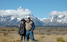
Just to show that I actually hiked all the way to the lake. My GPS said this is about 8,600 feet, which is about the same altitude or higher than the base of Brighton and Alta. It's like hiking from the S-curve to Brighton but straight up. Do I look tired?

This is part of the trail. It looks innocent enough, because this isn't the part with the tree root that jumped out and grabbed my foot and made me fall like a chopped tree. Unfortunately, the trail was really steep, so I fell beyond horizontal before my lower jaw stopped me in the rocks and dirt. I would have taken a picture of the blood cascading down the side of my arm, but my camera's lens hood was jammed onto the lens. The next time I think, "I should put my camera in its case rather than around my neck," I will not tell myself, "but it would be more convenient around my neck." Luckily, I was able to cut the lens hood off with a Dremel tool when I got home, and the lens and camera seem ok. I would tell you how far up the trail the tree root is, but the display on my Garmin Forerunner 301 was crushed. But don't worry, because there are plenty of roots and rocks for clumsy people to trip on all the way up the trail. You'd think the forest service could pave the trail and put in a handrail. Would a 3.5-mile escalator be too much to ask for?
2 comments:
Lake Blanche, huh... I told you that one was a doozy. I am glad you got some pictures since we couldn't make it all the way to the top because of snow and I don't know if I can make that trek again. It was hard.
I am very sorry about your camera. That stinks. I hope it will be okay.
Glad the camera is okay, oh and you too of course. I think that sounds like a place I could fall down a few times or more.
Post a Comment